
Kirk Langley
Footpaths in Kirk Langley: 39 Photographed locations: 27
Authority: Derbyshire County Council, Public Rights of Way Office
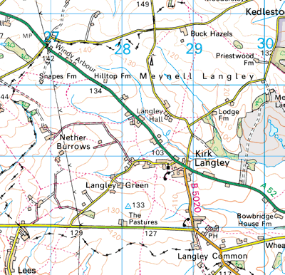


Image produced from the Ordnance Survey Get-a-map service.
Image reproduced with kind permission of Ordnance Survey
and Ordnance Survey of Northern Ireland.
Image reproduced with kind permission of Ordnance Survey
and Ordnance Survey of Northern Ireland.
The squares
on the map indicate photographed locations. Hold your mouse pointer over a square to see the path number and a brief description of the photograph.
Click to see the photograph(s).
- FP1: Sign invisible, covered in ivy (SOLVED) 2 photos
- FP2: Broken stile (SOLVED) 2 photos
- FP3: Broken stile (SOLVED) 2 photos
- FP3: Broken stile (SOLVED) 2 photos
- FP3: Broken stile (SOLVED) 2 photos
- FP5: Signpost broken, Buckhazels Lane
- FP6: Sign overgrown (SOLVED) 2 photos
- FP8: Path obstructed by barbed wire fence (SOLVED) 4 photos
- FP9: Stile missing through step
- FP13: Gate tied shut (SOLVED) 2 photos
- FP18: Broken fingerpost
- FP22: Broken sign (SOLVED) 2 photos
- FP24: Sign overgrown (SOLVED) 2 photos
- FP24: Obstructed by overgrown hedge
- FP25: Broken stile (SOLVED) 2 photos
- FP29: Path obstructed by wooden fence (SOLVED) 3 photos
- FP29: Path obstructed by hedge (SOLVED) 3 photos
- FP31: Sign badly positioned behind hedge, overgrown
- FP31: Path overgrown, impassable
- FP32: Path obstructed by new fence and hedge
- FP32: A squeeze stile has been obstructed by nailing a wooden batten across it
- BW36: Broken sign (SOLVED) 2 photos
- FP37: Path obstructed by gates firmly tied shut with twine (SOLVED) 3 photos
- FP37: Path obstructed by deep water and mud
- FP37: Sign broken off (SOLVED) 2 photos
- FP38: Path obstructed by hedge (SOLVED) 2 photos
- FP38: Broken sign (SOLVED) 3 photos