
Weston Underwood
Footpaths in Weston Underwood: 49 Photographed locations: 37
Authority: Derbyshire County Council, Public Rights of Way Office
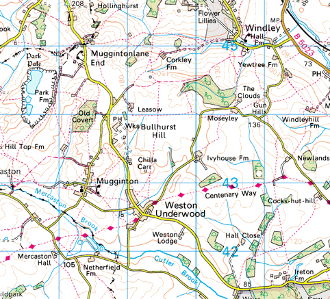


Image produced from the Ordnance Survey Get-a-map service.
Image reproduced with kind permission of Ordnance Survey
and Ordnance Survey of Northern Ireland.
Image reproduced with kind permission of Ordnance Survey
and Ordnance Survey of Northern Ireland.
The squares
on the map indicate photographed locations. Hold your mouse pointer over a square to see the path number and a brief description of the photograph.
Click to see the photograph(s).
- FP10: Stile has no through step (SOLVED) 2 photos
- FP11: Path obstructed by pallets (SOLVED) 2 photos
- FP11: Signpost fallen over (SOLVED) 2 photos
- FP12: Path under water
- FP14: Broken stile (SOLVED) 2 photos
- FP15: Path obstructed by hedge, no stile visible (SOLVED) 2 photos
- FP15: Path under water
- FP17: Signpost obscured by hedge
- FP18: Gate jammed shut (SOLVED) 2 photos
- FP19: Electric fence across path (2 photos)
- FP20: Broken stile (SOLVED) 2 photos
- FP22: Path obstructed by slurry, about 4 inches deep (SOLVED) 2 photos
- FP22: Path obstructed by hurdles (SOLVED) 2 photos
- FP22: Sign invisible, covered in ivy (SOLVED) 2 photos
- FP23: Sign obscured and badly positioned
- FP26: Rotten through step, path obstructed by gorse bushes (SOLVED) 2 photos
- FP28: Sign invisible, covered in ivy (SOLVED) 2 photos
- FP28: Broken stile (SOLVED) 2 photos
- FP28: Rotten stile (SOLVED) 2 photos
- FP29: Broken stile (SOLVED) 2 photos
- FP29: Path obstructed by wooden fence (SOLVED) 2 photos
- FP31: Sign invisible, covered in ivy (SOLVED) 2 photos
- FP37: Broken stile (SOLVED) 2 photos
- FP37: Rotten and broken through step (SOLVED) 2 photos
- FP37: Overgrown
- FP38: Stile in poor condition (SOLVED) 2 photos
- FP38: Electric fence across path (SOLVED) 2 photos
- FP39: Collapsed fence and stile (SOLVED) 2 photos
- FP43: Collapsed through step, overgrowth (SOLVED) 3 photos
- FP43: Collapsed through step (SOLVED) 3 photos
- FP43: Path overgrown, impassable (SOLVED) 2 photos
- FP44: Sign invisible, covered in ivy (SOLVED) 2 photos
- FP44: Rotten and broken through step (SOLVED) 2 photos
- FP48: Gate secured with knotted twine (SOLVED) 2 photos
- FP51: Path obstructed by wooden fence (SOLVED) 2 photos
- FP51: Very difficult stiles (SOLVED) 2 photos
- FP54: Overgrown