
Every inspector needs maps of the paths he/she is responsible for. Different maps are useful at different times. I use three kinds of map. I created two of them myself using computer software. I've made that software available on this site, for you to use, providing your area is one of those for which digital footpath data has been released by the relevant Highway Authority.
The interactive computer map
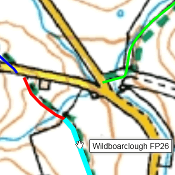 My Path Finder web page provides an interactive Ordnance Survey map with footpath routes and numbers superimposed.
I use it for initial (desk-based) exploration of a new area, and for establishing the grid references of any faults that I need to report.
My Path Finder web page provides an interactive Ordnance Survey map with footpath routes and numbers superimposed.
I use it for initial (desk-based) exploration of a new area, and for establishing the grid references of any faults that I need to report.
The printed maps
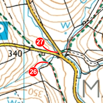 My Path Mapper web page is for printing maps.
I used the printed maps to plan inspection visits, and for general navigation during the visits themselves.
My Path Mapper web page is for printing maps.
I used the printed maps to plan inspection visits, and for general navigation during the visits themselves.
Most of my parishes need more than one A4 sheet, so I trim them and tape them together to make one large map that I can fold and stuff into my pocket.
Often I want to add extra information to a map, and for that I use erasable coloured pens - the Pilot Frixion Ball type work very well.
The phone map
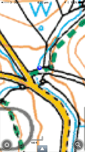 My printed maps usually tell me where I am but occasionally things can get difficult.
So I've installed the OutDoors GPS app in my iPhone, together with 1:25000 Ordnance Survey maps for the counties I work in.
My printed maps usually tell me where I am but occasionally things can get difficult.
So I've installed the OutDoors GPS app in my iPhone, together with 1:25000 Ordnance Survey maps for the counties I work in.
The app shows me exactly where I am on the map (the blue blob near the centre of the screen, right) even when there's no phone signal. Its large scale and illumination mean that I can easily use it without having to get my reading glasses out of my pocket.