The society doesn't dictate how inspectors should record inspections. Each inspector will find the system that suits them best. There are probably as many ways of recording inspections as there are inspectors. On this page I describe what I do. I'm not recommending this system for everyone.
On-the-spot records: equipment
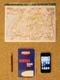 During an inspection, the things I have in my pockets for making records are:
- A printed map showing the path locations and numbers, for reference (see topic Maps). I put each map (or two maps back-to-back) into a clear A4 plastic pocket for protection.
- A notebook (about A6 size, to fit in my pocket) and pencil. It's easy to lose a pencil, so I always have a spare in my rucksack.
- A mobile phone. Most phones take perfectly adequate pictures for recording faults etc, and record the location using GPS.
- Also (not pictured) I take a tape measure, so that I can describe a constricted path as being (for example) "35 cm across" rather than just "narrow" or "tight".
On-the-spot records: what I record
 I make an entry in my notebook for every path inspected,
not just faults. A tick or a path number seems inadequate on its own so I note how the path ends. There are several possibilities, for example
a metalled road, another footpath, the parish boundary, or a dead end. I also note what kind of sign or waymark
there is at each end, if any. All this is done with rather cryptic codes which you can see in the illustration.
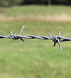 Obviously I also note any faults that I find,
perhaps with a sketch map to record the location, and always with a photo (as a reminder of the location, at the very least). Sometimes it's
not clear whether it's a fault or not: if in doubt, I record all the information, and make a decision about whether
to report it later.
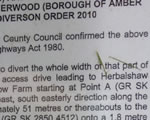 Also if I come across a relevant planning
notice, temporary closure order, diversion order, etc, I take a photo of that.
Home records
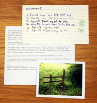 At home I actually keep my records on a PC
(see page My Computer) but
there's no reason why I couldn't do it the traditional way with a loose-leaf folder or a card index — the
principles are exactly the same:
- A section for each parish
- A page for each footpath
- On each page, a dated log of every inspection (copied from the notebook), photo, letter, etc for the path concerned
- The letters and photos themselves
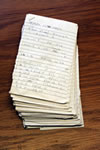 I also tear the pages out of my notebook and
keep them, just in case. To stop the notebook falling to pieces, I use pages alternately from the front and the back.
 Finally I keep my maps updated with all applicable
diversion orders, etc.
Sometimes a path has been partially extinguished, leaving two (or even three) separate paths with the same number. For my own record-keeping purposes only I make up a different path number for each, such as "7w" and "7e" for the western and eastern sections of path 7.
Taylor House records
The faults database at Taylor House contains a list of outstanding faults, which Hilda maintains using the information contained in my messages. Occasionally she sends me a listing of the database for "my" parishes, which I check against my own records, and send in any corrections.
